


WHAT'S NEW
 |
Updated Washington Tsunami Design Zone
On March 15 we released an update to the Washington Tsunami Design Zone for the new Washington State Building Code. Read more on the updated WA-TDZ webpage. |
|
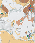 |
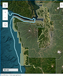
Aggregate Resource Inventory for Skagit County
On March 12 we released a new aggregate resource map for Skagit County at a scale of 1:100,000. Click here to download the map and pamphlet. |
|
 |
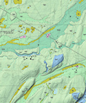
Geologic map of the Bald Hill 7.5-minute quadrangle
On December 27 we released a new geologic map of the Bald Hill quadrangle at a scale of 1:24,000. Click here to download the map and pamphlet. |
|
 |
Geologic map of the Harts Lake 7.5-minute quadrangle
On December 27 we released a new geologic map of the Harts Lake quadrangle at a scale of 1:24,000. Click here to download the map and pamphlet. |
|
 |
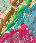
Geologic map of the Kittitas and E. Kittitas quadrangles
On December 27 we released a new geologic map of the Kittitas and East Kittitas quadrangles at a scale of 1:24,000. Click here to download the map and pamphlet. |
|
 |
Adams Mountain and Hunters quadrangles geologic map
On December 27 we released a new geologic map of the Adams Mountain and Hunters quadrangles at a scale of 1:24,000. Click here to download the map and pamphlet. |
|
 |
New tsunami modeling for southwest Washington rivers
On December 14 we released a series of new maps showing modeled tsunami inundation and current speed for the Chehalis, Hoquiam, Willapa, and Wishkah Rivers. Click here to check out the publication! |
